


お知らせ
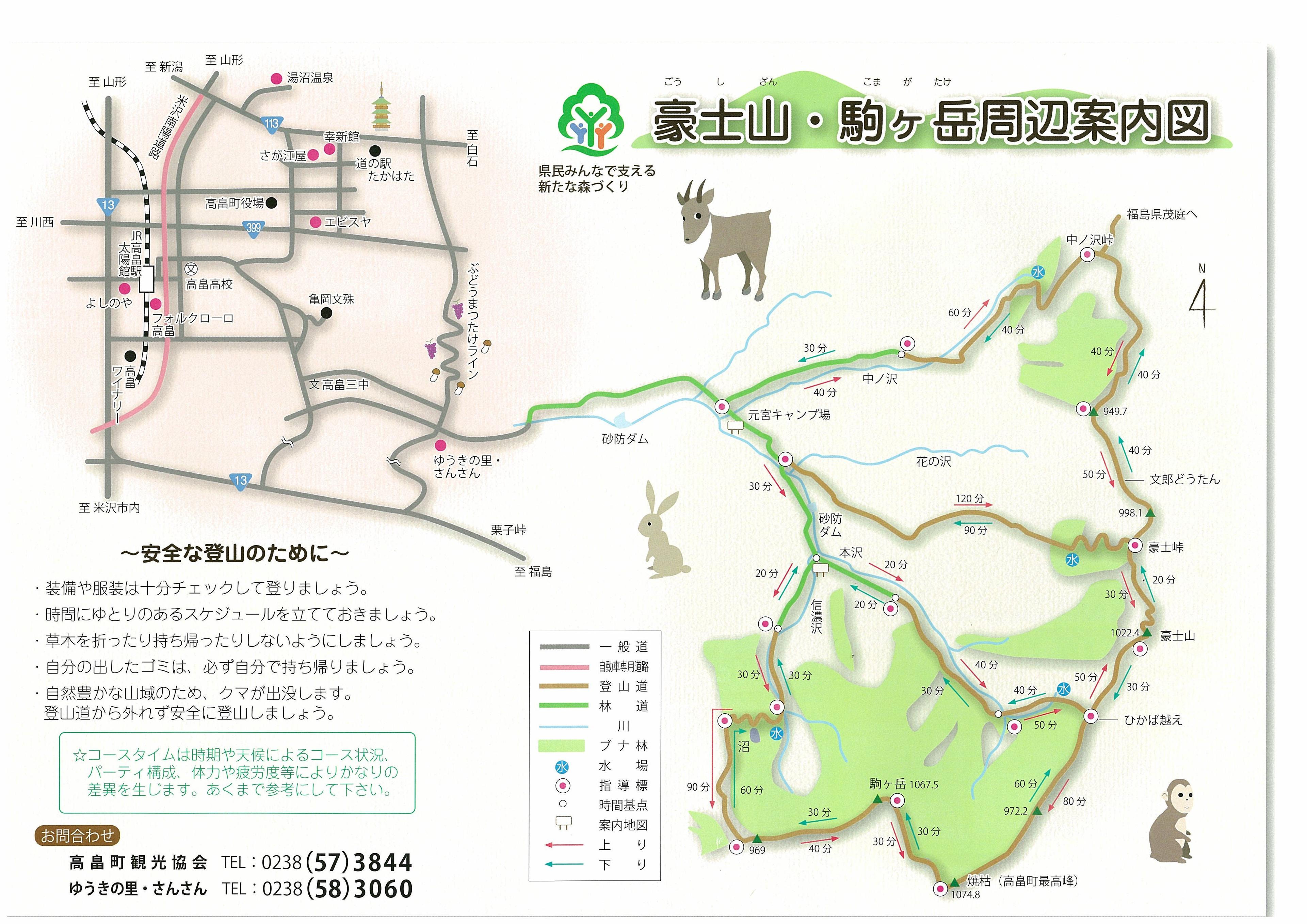
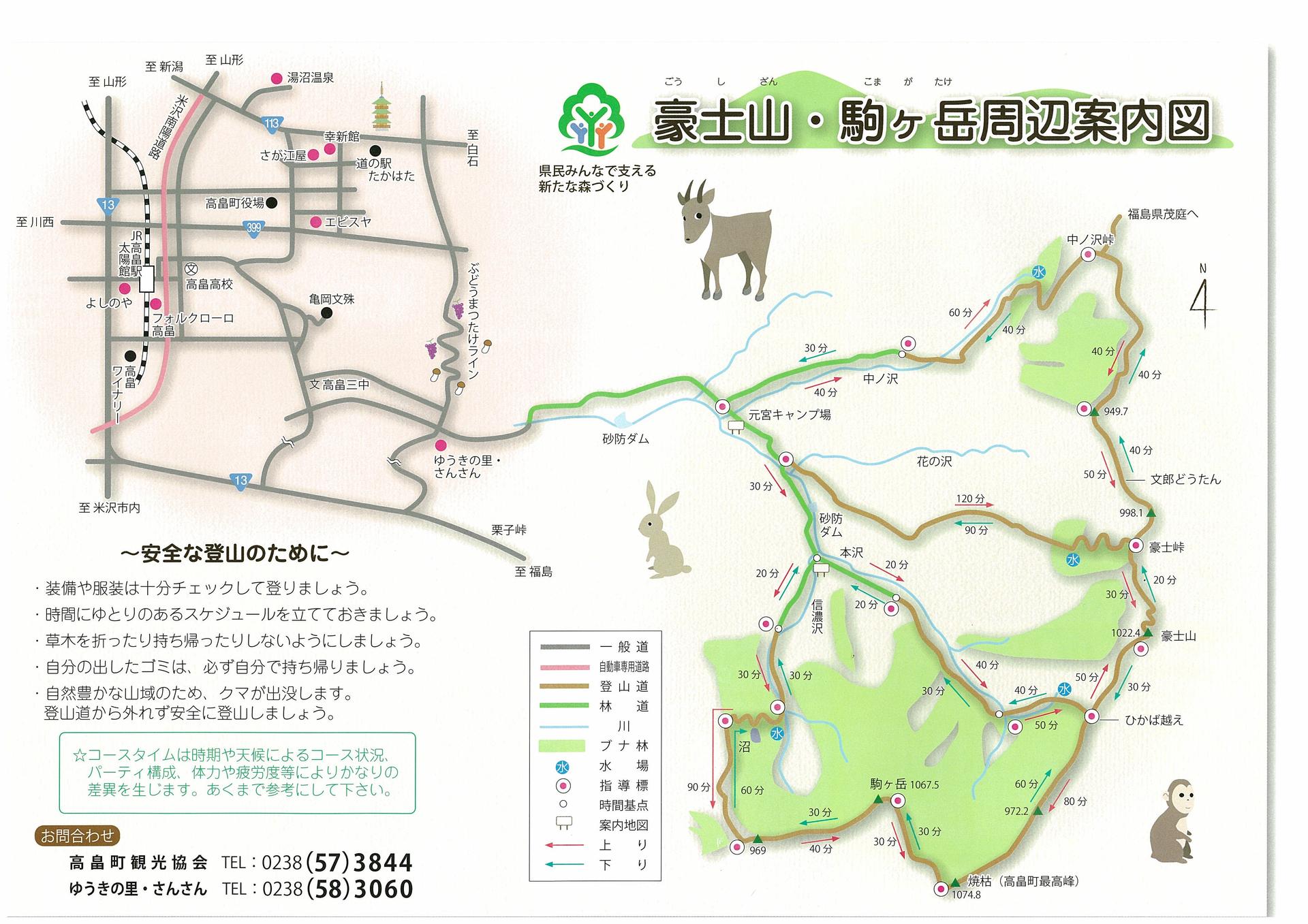
◆Gōshiyama and Komagatake Course Guide @@@
2011年6月30日
				<a href="https://qnsmjrftzzddmdtbzmih.supabase.co/storage/v1/object/public/site-images/articles/takahata/log-241434-01.jpg" target="_blank"><img src="https://qnsmjrftzzddmdtbzmih.supabase.co/storage/v1/object/public/site-images/articles/takahata/log-241434-01.jpg" style="max-width:480px;" alt="◆Gōshiyama and Komagatake Course Guide @@@: Image"></a>


			</div>


						<p>
				<a href="https://ssl.samidare.jp/~lavo/toda/box/img-701161315.pdf" target="_blank" >- PDF file [img-701161315.pdf] </a><br>
				<br>
			</p>
										<p>
				We are pleased to announce the completion of a new hiking map.<br><br>Please check the PDF.<br><br><br>We have just confirmed information from the mountain club.<br><br>There are no major stream collapses when descending from Hikaba Pass.<br><br>However, there are about two places where you have to cross a stream along the way.<br><br>Pink ribbons serve as markers, so please confirm and cross.<br><br>Also, if you have any questions, please contact us.<br><br>Please contact the Takahata Town Tourism Association at 0238-57-3844.<br><br><br><br>				</p>