


お知らせ
◆Mount Goshi & Mount Komagatake Hiking Trail Information◆
2013年7月31日
<a href="https://qnsmjrftzzddmdtbzmih.supabase.co/storage/v1/object/public/site-images/articles/takahata/log-327602-01.jpg" target="_blank"><img src="https://qnsmjrftzzddmdtbzmih.supabase.co/storage/v1/object/public/site-images/articles/takahata/log-327602-01.jpg" style="max-width:480px;" alt="◆Mount Goshi & Mount Komagatake Hiking Trail Information◆: Image"></a>
</div>
<p>
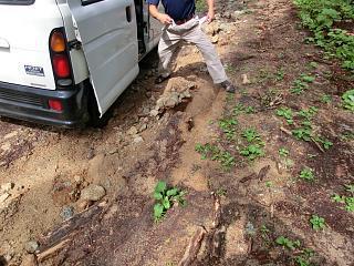
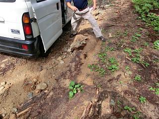
</p><p>Due to the recent heavy rainfall, we were concerned about the condition of the hiking trails and have confirmed them.</p><p>The grass at the trailheads has grown more than expected due to this rain, but the path is still discernible, so it should be fine.</p><p>Regarding the access roads to the trailheads: the road to Motomiya Campsite has deeper ruts due to water flow,</p><p>but it is passable if you drive slowly.</p><p>On the Shinanosawa Trailhead access road, there is a hole in the bridge near the Y-junction with a sign, so please drive with extreme caution.</p><p>The access road from Honzawa has sections where the road has been washed away by water flow and is in a very dangerous condition. Please note that vehicle access is restricted partway along this road.</p><p>For climbing Mount Goshi, please park at Motomiya Campsite. For the Mount Komagatake circuit hike, please park near the Honzawa sign and walk to the trailhead.</p><p>The hiking trails along each stream are passable, but please be aware that they may become dangerous depending on future rainfall. Please enjoy your hike with caution.</p><p> </p>